Showing posts with label Hurricanes. Show all posts

Friday, October 29, 2010

Rare, late season Tropical Storm Tomas forms

You can get the latest official forecast—and plots of the global forecast models used by the National Hurricane Center—at the Tropical Update Page.

Right now, most of the forecasts have the storm just south of Jamaica by Wednesday of next week.  After that, the models agree that the storm will be picked up by the trough currently off the East Coast.

We’ve been extraordinarily fortunate this year. Tomas is the 20th named storm of the season, but we haven’t had a single major storm make landfall in the continental US.

Tuesday, September 14, 2010

Scientists: Tropical activity may shift closer to US soon

Eric Berger, the Houston Chronicle’s official science nerd, has an item in his SciGuy blog today, discussing the current state of the tropics, and why forecasters think activity may be moving closer to our neck of the woods in the next two to six weeks:


Although Hurricane Alex and Tropical Storm Hermine produced some dicey weather conditions in Texas, the United States has been spared a direct strike by tropical weather this year. The biggest storms have formed in the deep tropics and curved north before reaching the Caribbean Sea.

I'll have a story in the Chronicle on Wednesday about why this has happened, but in speaking with ImpactWeather's Chris Hebert this week he told me that pattern may be about to change.

Chris noted that the focus of storm development should shift from the eastern Atlantic to the western part of the basin, including the Caribbean Sea and Gulf of Mexico. Climatologically this also begins to happen during the latter half of September.

One factor that could drive storm formation closer to the United States during the coming few weeks is a shift from "sinking air" in the atmosphere, which dampens thunderstorm activity, to "rising air."

One way to forecast sinking air is to measure the outgoing longwave radiation, the amount of energy leaving the Earth as infrared radiation at low energy. This measurement provides information on cloud-top temperature which can be used to estimate tropical precipitation amounts.

In short, negative values indicate more storm activity and positive values less activity.

The western Atlantic basin has generally seen positive values in recent weeks but as the outgoing longwave radiation forecast maps below show, that should change during the latter half of September and early October.


OLR091410.jpg


Climatologists are much better at predicting the chances of short-range weather—which is why you can usually trust your seven-day local forecast and safely ignore the forecast of a coming global climate change catastrophe.  If these models are accurate, there could be an increased amount of tropical activity originating and traveling through the Caribbean and Gulf of Mexico.

So far, it’s been a relatively quiet and uneventful season for the Gulf Coast.  That might change in the new few weeks.  We’ll see.

Friday, September 3, 2010

Long Island Earl: Latest Enhanced Satellite Imagery

Not as impressive on satellite as yesterday or Wednesday, but he’s still a big storm and he’s still gonna make a mess somewhere.

hifloat5_None_anim

Thursday, September 2, 2010

It’s a Monster! Hurricane Earl Enhanced Satellite Imagery

Updated to include the latest satellite loop. 

This storm is a monster and even a glancing blow is gonna mess up some stuff.

As the weatherman says, “plans to protect life and property should be rushed to completion.”

You can see the latest update of this loop at Intellicast.

hifloat5_None_anim

Wednesday, September 1, 2010

Hurricane Earl: Long Island Express II?

The 1938 Long Island Express (aka The Great Hurricane of 1938) was the first major tropical cyclone to make landfall in the coastal area of Long Island and New England since 1869.  A classic Cape Verde storm, the Express formed off the coast of Africa in mid-September.  It was believed to have reached Category 5 status on the Saffir-Simpson Hurricane Scale (the Saffir-Simpson scale wasn’t invented until 1971, but bear with me), then weakening and making landfall as a Category 3 hurricane.

640x415 On September 21, it struck just west of Mystic Beach, New York on Long Island, in the vicinity of the Fire Island National Seashore. The storm crossed the Long Island, then the sound, and struck a second time near the Bridgeport-Miflord-New Haven area.

The hurricane was estimated to have killed as many as 800 people, damaged or destroyed nearly 60,000 homes and other structures, and caused property losses estimated at $ 4.72 billion in damages (in today’s dollars)

To date it remains the most powerful, costliest and deadliest hurricane in New England history.  To date.

Hurricane Earl is on a path quite similar to the path estimated to have been followed by the Express.  See the map below. There were no satellites, no Doppler Radar, and no Hurricane Hunter aircraft in 1938.  So forecasters basically made educated guesses as to storm paths and landfall locations. The shaded area on the map is the modern day equivalent of the educated guess.

LIExpress2

More than likely, the storm will stick to somewhere in the middle of that range.  But the National Hurricane Center takes no chances.  Appended to the end of their forecast discussion on the 11:00 am EDT forecast discussion for September 01, 2010:


THIS IS A GOOD TIME TO REMIND EVERYONE THAT NHC AVERAGE TRACK FORECAST ERRORS ARE 200 TO 300 MILES AT DAYS 4 AND 5.  GIVEN THIS UNCERTAINTY...IT IS TOO SOON TO DETERMINE WHAT...IF  ANY...PARTS OF THE U.S. EAST COAST MIGHT SEE DIRECT IMPACTS FROM EARL LATER THIS WEEK.


Gimme some feedback in the comments

Tuesday, August 31, 2010

NOLA—and Obama—should be thankful for George W. Bush

Heritage’s Rob Bluey has a great opinion piece in the Daily Caller today, rightly placing credit for New Orleans’ degree of protection from future storms. 

Bluey gets it right and sadly, he seems to be the only conservative who does so.

Katrina was a once-in-a-lifetime combination of meteorology, geography and hydraulics.  It’s not likely to happen again for a very, very long time.  But if it does, New Orleans stands a much better chance of surviving.

Credit for that goes to George W. Bush, and Bluey lays it out:


The city’s fortunes might be different had Bush not taken a deeply personal interest. His televised speech from Jackson Square two weeks after Katrina marked a turning point. Bush created the Office of Gulf Coast Rebuilding to coordinate the region’s recovery — an office Obama abolished earlier this year. And in 2008, Bush struck a landmark deal with Louisiana to pay back within 30 years its $1.8 billion portion of the hurricane prevention project.

“Thank you, Mr. President,” the Times-Picayune wrote after Bush granted the executive order.

Today there is growing confidence among residents about the new system being built to shield the city from a hurricane. According to a recent Kaiser Family Foundation poll, 74 percent of respondents were upbeat and 70 percent said the recovery was heading in the right direction. Louisianans also give Bush higher marks for his response to Katrina than Obama’s handling of the Gulf oil spill — by a margin of 54 percent to 33 percent, according to Public Policy Polling.

It helped that New Orleans remained dry after Hurricane Gustav hit in 2008. Now, two years after that storm, the system is even more robust. When construction and reinforcement of levees, flood walls and pump stations are done next June, the city will be protected from a hurricane twice the strength of Katrina, which had storm surge of up to 28 feet and waves up to 55 feet — the highest ever recorded in North America.

Karen Durham-Aguilera, the civilian director of the Corps’ Task Force Hope, credits the Bush administration for securing full funding for the project. That eliminated costly turf wars and bureaucratic holdups.

“We’re not even on the same universe as we were before Katrina,” Durham-Aguilera said of the threat posed by a hurricane. “There’s just no comparison. That’s why even during Gustav, when it was only partially complete, it held up. If we get hit this year — and we very well could — we’re better off than a year ago.”


Bluey is something of an outlier among conservatives in that he’s identified a successful federal endeavor—rebuilding the levee system—and giving proper credit for why it’s been successful.  There are two reasons why New Orleans is better protected now than at any time in its history: (1) The administration forced the US Army Corps of Engineers to use good science and (2) the administration forced the agency to develop a schedule for completion and stick to it.  The result: good government.  The Obama administration is just going along for the ride, and taking credit for the success when none is deserved.

On the other hand, conservative bloggers, pundits and talkers are following this line of thought.  These kinds of comments are neither wise nor helpful, because they demonstrate either naiveté or willful ignorance about New Orleans, the Hurricane Storm Damage Risk Reduction System (HSDRRS), or the root causes of the levee failures five years ago.  There are no ideological or political points to be scored by dismissing the “bellowing for federal dollars” and comparing the “people down there” to helpless infants. The federal government put the area at risk by constructing poorly designed levee systems.  Ergo, the federal government should be responsible for making it right.  And don’t even start the argument about whether people should live there or not.  New Orleans was placed where it was for strategic purposes, and it remains where it is out of national economic necessity.  The port of New Orleans isn’t closing, the oil and gas industry isn’t going anywhere and all of the people who make those industries work need a place to live. 

What the Bush  administration did—and did quite well—was make sure that the Corps got it right this time.  So far, so good.  The projects are on schedule.  The projects are within budget.  The projects use good science and engineering.  That’s good government, and conservatives should take notice when government gets it right. 

It doesn’t happen very often.

Gimme some feedback in the comments.

Monday, August 30, 2010

Hurricane Earl is now a monster Cat IV, RADAR loop shows entire eye wall

The bad news:  Hurricane Earl has been upgraded—again—to a Category IV storm.

The good news:  Earl has apparently started to make the long awaited turn towards the northwest, beginning the days-long recurvature process that will hopefully take the storm away from any major North American landmass.

The entire eye-wall of the storm is now clearly visible on the long range NEXRAD RADAR loop from San Juan, Puerto Rico.  On a historical note, my very first Hurricane deployment was for Hurricane Hugo, which devastated San Juan in 1989.

Here’s the latest project path of Earl’s hurricane force (+75 mph) winds.

Oh, and there’s some more bad news:  Fiona has formed in Earl’s wake, and both the CLPS and BAMD forecast models have that system entering the Gulf of Mexico.

Should either Earl or Fiona stray too far to the west in the next 24-48 hours (36-60 hours for Fiona), the area from the Outer Banks of North Carolina up to Atlantic, Nova Scotia could see Hurricane force winds by this time next week.

Earl striking the coast of the US is a longshot.  Fiona, not so much. 

As always, you can track any of these storms using the Tropical Update page, located here, which will let you see the same model forecast paths used by the National Hurricane Center.

Gimme some feedback in the comments.

Hurricane Earl upgraded, watches and warnings may be issued for East Coast

As of the 11:00 am advisory, Hurricane Earl has been upgraded to a Category III storm, with wind intensity estimated at 105 knots.  Forecast models continue to suggest the storm will recurve, beginning its turn in the next day or so.  But Earl has been stubbornly tracking to the west or west-northwest.  The cone of uncertainty takes the storm dangerously close to the upper east coast.

Watches and warnings are likely within the next day or so.

You can see the forecast model guidance in the StormPulse page on this blog, found here.

Gimme some feedback in the comments.

Sunday, August 29, 2010

Remembering Hurricane Katrina: A First Responder’s View

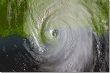
katrina-08-29-2005-1315z2 Five years ago today, the mother of all Hurricanes made landfall, first near Buras, Louisiana in South Plaquemines Parish, and later near Bay St. Louis, Mississippi.  My home in Mobile, Alabama suffered minor roof damage and two downed oak trees.  To the south however, Bayou La Batre was swamped with a 10+ foot storm surge, devastating the small fishing village overlooking Mississippi Sound.

My background in engineering and construction makes me one of the first people to enter a storm-ravaged area.  We do damage assessments for the purposes of federal disaster declarations, insurance companies and state, local and federal government agencies.  We’re some of the first boots on the ground and we have near unrestricted access.

Right after the storm, I led an American Society of Civil Engineers’ damage assessment team in a survey of the three-county coastal area of South Mississippi.  A separate group of teams did similar damage assessments in Louisiana, but none of our people were allowed in New Orleans until many weeks after the storm.

The damage in Bayou La Batre was very bad, but nothing prepared me for the devastation I witnessed on the coast, just days after the storm passed. From Pascagoula west to Bay St. Louis, it was like a nuclear bomb had gone off.  I stood in an area that was once filled with single-family houses that had nothing standing.

The image below shows an example of what we saw.

DSC_0623

Entire neighborhoods were wiped from the face of the earth.  Where houses had stood in block after city block, the only things remaining were concrete foundations, the occasional concrete steps to non-existent front doors, and centuries old Live Oak trees.  The trees were still standing, but salt water inundation killed almost all of them. 

In the high-resolution satellite image below, the brownish, orangish areas are what’s called the “wrack line.” It’s the debris caused by the storm surge, and it extended as much as three-quarters of a mile inland from the coast line.  In some locations, the wrack line was 350 yards wide and piled 40 feet high.  It stretched for miles upon miles of the coast.  Everything on the seaward side of the wrack line was destroyed.  As the wrack pilled up, it became something of a breakwater, protecting everything behind it from the raging floodwaters and towering waves.

This image is scaled and rotated for faster loading and proper orientation.  You can see the ultra-high resolution version of this shot here.

Katrina-Wrack-2005

At the the port facilities in Gulfport, several hundred refrigerated containers were left in sturdy warehousing facilities to ride out the storm.  Port authorities secured them to the best of their abilities, but no one knew just how much energy all that water threw at the coast. The storm surge tossed these containers around like matchboxes, breaking them open and strewing their contents all over the place.  The stench of rotting chicken, rotting vegetables and fruit was gagging.  It was thick, wet and heavy, and no breeze from the water would blow it away from you. Since the flood water had penetrated every nook and cranny of the debris, so did the food items that floated in it.  Whole, previously frozen chicken carcasses were wedged between broken roof rafters.  Packages of bacon, sausage and processed meats were stuck between tree branches, beneath steps, into storm drains.  Breathing became nearly unbearable.  Several of our team members were overcome with nausea.  The heat, the humidity, the smell, the trauma was too much to bear.  We had to go.

DSC_0610

Since we were one of the first damage assessment teams on the ground, part of our task was to get an early estimate of the storm surge elevation.  That is, we were tasked with determining the height of the surge at “ground zero.”  In the image below, a colleague of mine observes a benchmark elevation on a bridge near Bay St. Louis.  The elevation at the location is 19.1 feet above sea level.  Immediately behind the bridge wall are pine trees with the tell-tale rub-line clearly visible.  The rub-line is caused when floating debris impacts the trees and removes bark.  At this location, the center of the rub-line is approximately 6.0 feet above the benchmark, meaning that at this location, the storm surge was estimated to be a whopping 25 feet above sea level.  Additional measurements taken further east were on the order of 30 to 32 feet. It’s the highest measured storm surge in modern US History.

DSC_0684

In the image below, you can see what happened to the bridge.  When this bridge was built, the construction methods of the time called for gravity mounting of the decking sections.  The sections were believed to be so heavy that simply placing them atop the bridge bents and using light steel bolts would suffice.  You can see the results of that.  The waves lifted the bridge sections off of their bents and either dropped them where they were, or moved them several yards away.

DSC_0701

Some of the most tragic damage caused by Katrina’s storm surge was done to the area’s historic structures.  Buildings that were constructed in the antebellum period between 1820 and 1860 had stood through storms in 1906, 1916 and Camille in 1969.  They were no match for Katrina, and some of the most architecturally unique buildings on the Gulf Coast were obliterated.  St. Stanislaus College, founded in 1854 had only the church and a recently built student center escape catastrophic damage.  Waterfront cottages in Bay St. Louis, Waveland and Ocean Springs were wiped clean.

DSC_0109 DSC_0128

A favorite meme of the national news media had anchors and correspondents screaming at the camera: “WHERE ARE THE SUPPLIES?  WHERE IS FEMA?!?”

Here’s a major reason why supply lines were disrupted.  FEMA had staged hundreds of rail cars with food, water, medical supplies and other materials in areas believed to be lightly damaged by the storm.  What they didn’t anticipate was the near complete destruction of the rail lines themselves.  The railroad is more than one mile inland, and the top of the rail is supposed to be above the elevation of the 100-year flood event.  But Katrina was no 100-year event.

DSC_0014

In Southern Mississippi, state and local coroners estimated that 175 people lost their lives during Katrina.  The National Guard was still doing door-to-door searches as we were working our way west.  From time to time, our paths crossed. In fact, we ran into the same Virginia National Guard unit three different times.  They declined to be photographed.  But in this image, which still sticks with me today, you can see the spray-painted marking designating that the house had been searched.  USANG search teams crawled over the wrack line to reach this house, where they found two.  In the one behind it, two more.

DSC_0062

I pray all the time for the repose of the souls who lost their lives during the storm five years ago.  I can only imagine the horror of their last few hours, and the horrors of those who managed to survive.  At mass today, I prayed for them again, and prayed that a Katrina never comes here, or anywhere else, ever again.

I hope you will pray for the same.

REMEMBERING HURRICANE KATRINA:


  • Katrina lessons linger on Gulf Coast, 5 years after devastating hurricane came ashore
  • As national spotlight shines on Lower 9th Ward, 5 years after Katrina its residents feel forgotten
  • Louisianians Give Bush Higher Marks Than Obama for Crisis Response
  • After 5 years, Gulf coast residents risie from Katrina's wrath
  • Will South Mississippi be recovered in five more years?
  • Thanks to Doug Ross @ Journal for the linkage.

    Gimme some feedback in the comments.