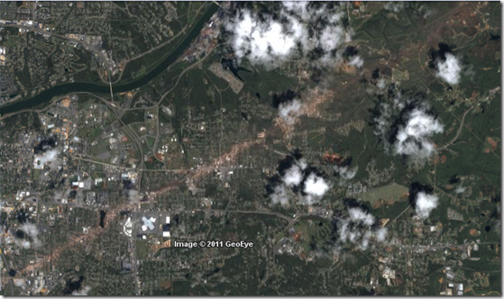
The high resolution satellite imagery of the storm paths through Tuscaloosa and Jefferson Counties is now available. Click here for the Tuscaloosa County KMZ file (for Google Earth). Click here for the Jefferson County imagery.
Click the image below to view the Tuscaloosa imagery in Google Maps (but the full resolution version in Google Earth is much better).
Rough order of magnitude distance estimates are eight miles for the Tuscaloosa path and about nine miles for Jefferson. Pretty much everything about a quarter to a half-mile on either side of the centerline would have been severely damaged or destroyed.
Even well built structures were obliterated.
Damage assessments continue, but these storms will almost certainly be rated EF-5, the worst possible. EF-5 storms are exceedingly rare. The last one to touch down in the US was the Iowa storm of 2008. The storm that laid waste to Smithfield, Mississippi has already been given an EF-5 classification.
Update to add: Since the Google Earth imagery is stored in KML format, these are viewable in resource and CPU hogging ArcGIS and compatible applications.
Follow me on Twitter and Facebook.


0 comments :
Post a Comment
You must have a Google Account to post a comment.
WARNING: Posting on this blog is a privilege. You have no First Amendment rights here. I am the sole, supreme and benevolent dictator. This blog commenting system also has a patented Dumbass Detector. Don't set it off.